1
/
of
1
Hometown History Maps
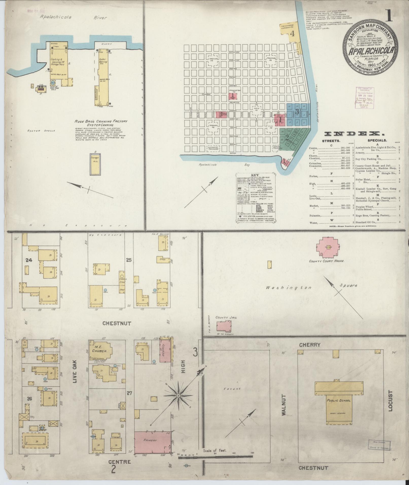
Sanborn Fire Insurance Map from Apalachicola, Franklin County, Florida. (1903)
Sanborn Fire Insurance Map from Apalachicola, Franklin County, Florida. (1903)
Regular price
$35.95 USD
Regular price
$39.95 USD
Sale price
$35.95 USD
Unit price
/
per
Shipping calculated at checkout.
Couldn't load pickup availability
🔒 Fast & Secure Checkout
✅ Proudly printed & shipped from small-town USA
📦 Ships same or next business day
🖨️ Premium quality paper, showing crisp detail
🚚 Free USPS Economy shipping
⚡️ UPS Ground available for quicker delivery
Share
Sanborn Fire Insurance Map from Apalachicola, Franklin County, Florida. (1903)
This is a high-resolution reproduction of a historic Sanborn fire insurance map sheet published in 1903. It’s part of our exclusive collection of old maps for sale, perfect for decor, research, or gifts.
Collectors often ask where can I buy Sanborn maps? Our shop makes it easy — this Florida map is printed on premium paper and ships ready to frame.
Map courtesy of the Library of Congress, Geography & Map Division.
🖨️ Print Size, Product Info & Disclaimer:
All Sanborn map prints are produced at 24" wide × 30" tall unless otherwise noted in the description above. The actual map image area measures 24" × 28", leaving 1" of extra space at the top and bottom to allow for easy trimming or to help center the map in a standard 24×30 frame. This ensures a frame-ready experience without the need for custom sizing.
🖼️ Other Print Types:
In addition to Sanborn Fire Insurance Maps, we also offer bird’s-eye views and other illustrated cityscapes. These prints are produced on 24" × 36" premium paper. To preserve the original proportions, we never crop — each image is centered with balanced white borders as needed to maintain its full composition. Please refer to the product description above for any specific size or format details.
📜 Historical Reproduction Notice:
These are high-resolution scans of original maps that are often more than 100 years old. As a result, you may see signs of scan lines, fold lines, Library of Congress stamps, ink marks, fading, or light creases. These unique characteristics are part of what makes each print historically authentic and visually engaging.
🎨 Color Accuracy:
Please note that colors may vary slightly from what you see on your screen due to differences in display settings and printed ink on satin photo paper. While we strive for excellent fidelity, no two screens—or printers—render colors identically.
📦 Safe Shipping:
Every map is carefully rolled and shipped in a 24" heavy-duty cardboard tube to prevent bending or damage during delivery. This ensures your print arrives safely and ready to frame.
🗺️ Map Accuracy & Availability:
These historic Sanborn Fire Insurance maps are reprints created from Library of Congress materials. While we work hard to include every available sheet, some titles or years may not display every page due to upload limitations or gaps in the source data. This applies to both single map sheets and complete sets, which may include title pages, index sheets, and more. We continually review and update our catalog to correct missing, broken, or misidentified uploads as we find them. Please review the preview images carefully — what you see here is exactly what you’ll receive. If you believe a sheet is missing or something doesn’t look right, please reach out — we’ll gladly research it and make it right.
No reviews
