-
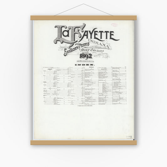
Sanborn Fire Insurance Map from Lafayette, Tippecanoe County, Indiana (1892), Sheet #0001
Regular price $29.95 USDRegular priceUnit price per$39.95 USDSale price $29.95 USDSale -
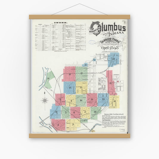
Sanborn Fire Insurance Map from Columbus, Bartholomew County, Indiana (1898), Sheet #0001
Regular price $29.95 USDRegular priceUnit price per$39.95 USDSale price $29.95 USDSale -
Sanborn Fire Insurance Map from Columbus, Bartholomew County, Indiana (1898), Sheet #0002
Regular price $29.95 USDRegular priceUnit price per$39.95 USDSale price $29.95 USDSale -
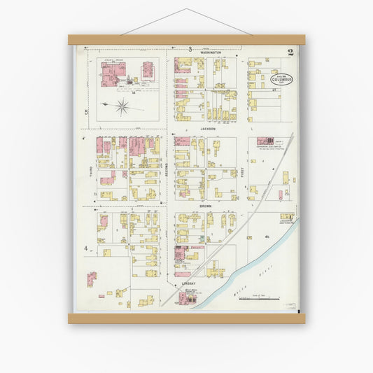
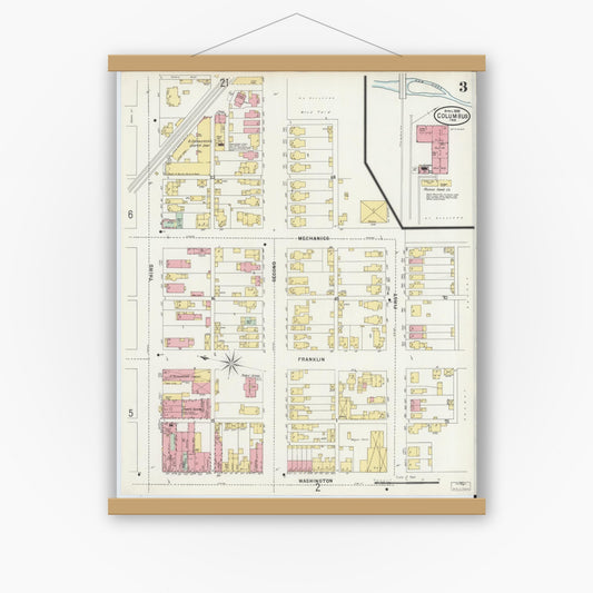
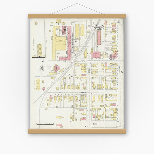
Sanborn Fire Insurance Map from Columbus, Bartholomew County, Indiana (1898), Sheet #0003
Regular price $29.95 USDRegular priceUnit price per$39.95 USDSale price $29.95 USDSale -
Sanborn Fire Insurance Map from Columbus, Bartholomew County, Indiana (1898), Sheet #0004
Regular price $29.95 USDRegular priceUnit price per$39.95 USDSale price $29.95 USDSale -
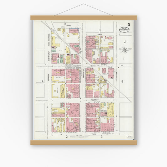
Sanborn Fire Insurance Map from Columbus, Bartholomew County, Indiana (1898), Sheet #0005
Regular price $29.95 USDRegular priceUnit price per$39.95 USDSale price $29.95 USDSale -
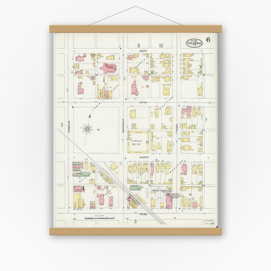
Sanborn Fire Insurance Map from Columbus, Bartholomew County, Indiana (1898), Sheet #0006
Regular price $29.95 USDRegular priceUnit price per$39.95 USDSale price $29.95 USDSale -
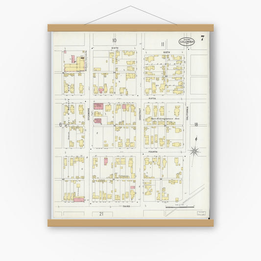
Sanborn Fire Insurance Map from Columbus, Bartholomew County, Indiana (1898), Sheet #0007
Regular price $29.95 USDRegular priceUnit price per$39.95 USDSale price $29.95 USDSale -
Sanborn Fire Insurance Map from Columbus, Bartholomew County, Indiana (1898), Sheet #0008
Regular price $29.95 USDRegular priceUnit price per$39.95 USDSale price $29.95 USDSale -
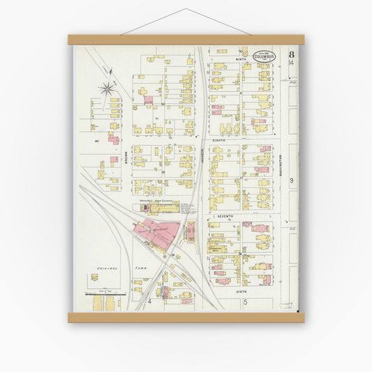
Sanborn Fire Insurance Map from Columbus, Bartholomew County, Indiana (1898), Sheet #0009
Regular price $29.95 USDRegular priceUnit price per$39.95 USDSale price $29.95 USDSale -
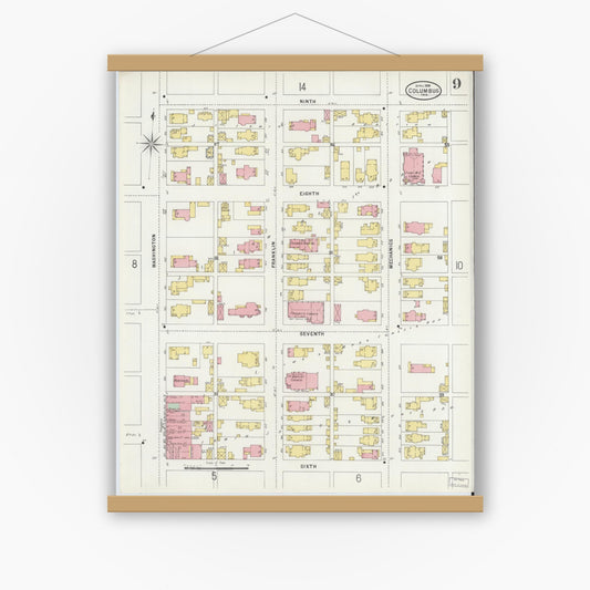
Sanborn Fire Insurance Map from Columbus, Bartholomew County, Indiana (1898), Sheet #0010
Regular price $29.95 USDRegular priceUnit price per$39.95 USDSale price $29.95 USDSale -
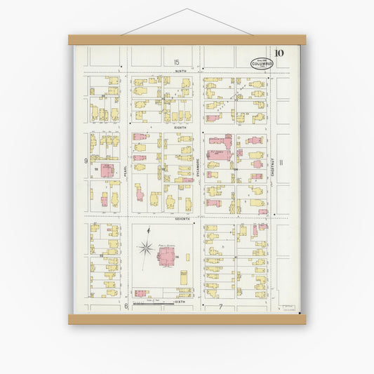
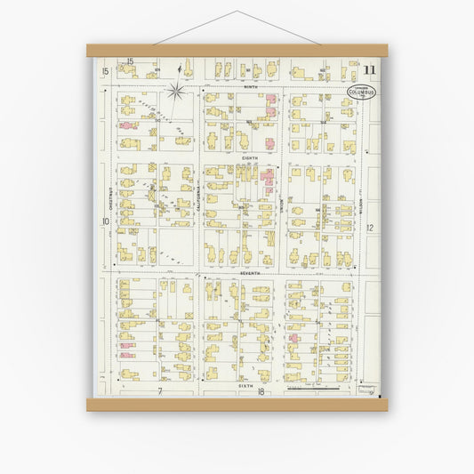
Sanborn Fire Insurance Map from Columbus, Bartholomew County, Indiana (1898), Sheet #0011
Regular price $29.95 USDRegular priceUnit price per$39.95 USDSale price $29.95 USDSale