-

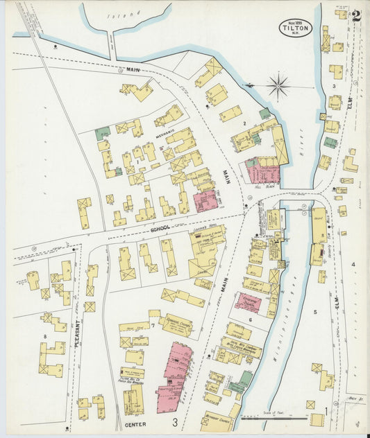
Sanborn Fire Insurance Map from Tilton, Belknap County, New Hampshire (1899) - Complete Map Set
Regular price $101.83 USDRegular priceUnit price per$119.80 USDSale price $101.83 USDSale -

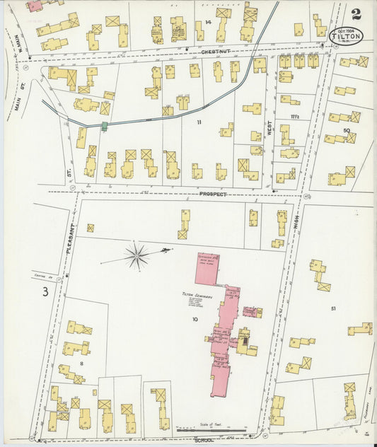
Sanborn Fire Insurance Map from Tilton, Belknap County, New Hampshire (1904) - Complete Map Set
Regular price $127.29 USDRegular priceUnit price per$149.75 USDSale price $127.29 USDSale -

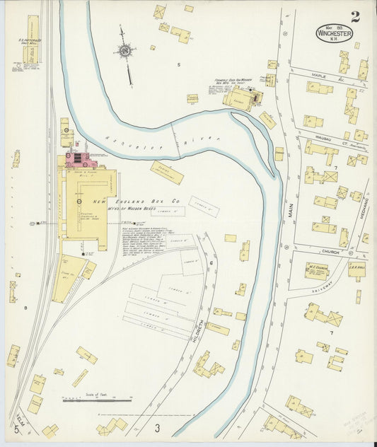
Sanborn Fire Insurance Map from Winchester, Cheshire County, New Hampshire (1913) - Complete Map Set
Regular price $127.29 USDRegular priceUnit price per$149.75 USDSale price $127.29 USDSale -

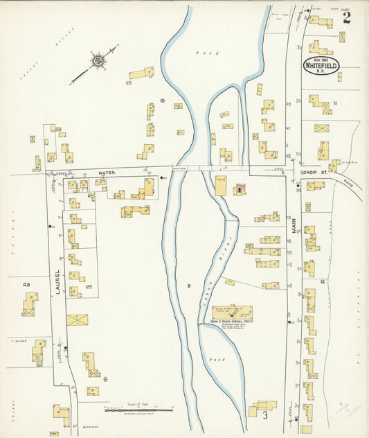
Sanborn Fire Insurance Map from Whitefield, Coos County, New Hampshire (1921) - Complete Map Set
Regular price $127.29 USDRegular priceUnit price per$149.75 USDSale price $127.29 USDSale -

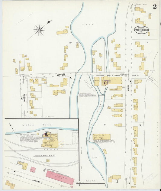
Sanborn Fire Insurance Map from Whitefield, Coos County, New Hampshire (1908) - Complete Map Set
Regular price $127.29 USDRegular priceUnit price per$149.75 USDSale price $127.29 USDSale -

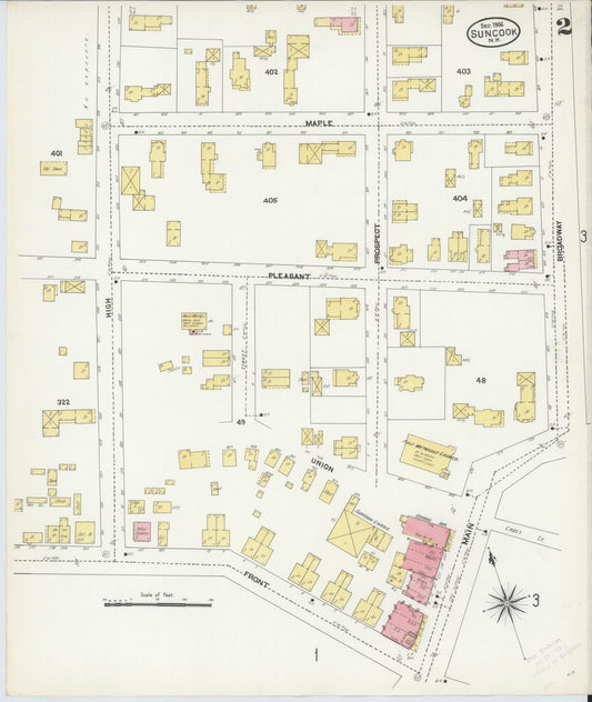
Sanborn Fire Insurance Map from Suncook, Merrimack County, New Hampshire (1906) - Complete Map Set
Regular price $127.29 USDRegular priceUnit price per$149.75 USDSale price $127.29 USDSale -

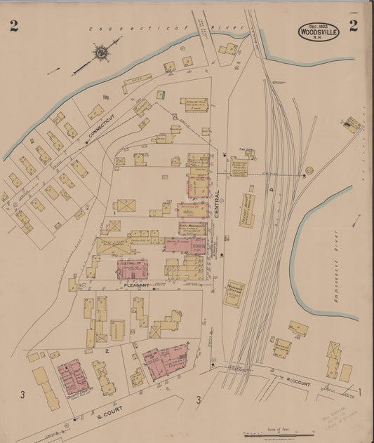
Sanborn Fire Insurance Map from Woodsville, Grafton County, New Hampshire (1922) - Complete Map Set
Regular price $152.74 USDRegular priceUnit price per$179.70 USDSale price $152.74 USDSale -

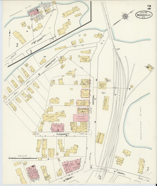
Sanborn Fire Insurance Map from Woodsville, Grafton County, New Hampshire (1912) - Complete Map Set
Regular price $152.74 USDRegular priceUnit price per$179.70 USDSale price $152.74 USDSale -

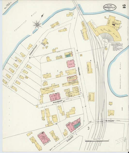
Sanborn Fire Insurance Map from Woodsville, Grafton County, New Hampshire (1905) - Complete Map Set
Regular price $152.74 USDRegular priceUnit price per$179.70 USDSale price $152.74 USDSale -

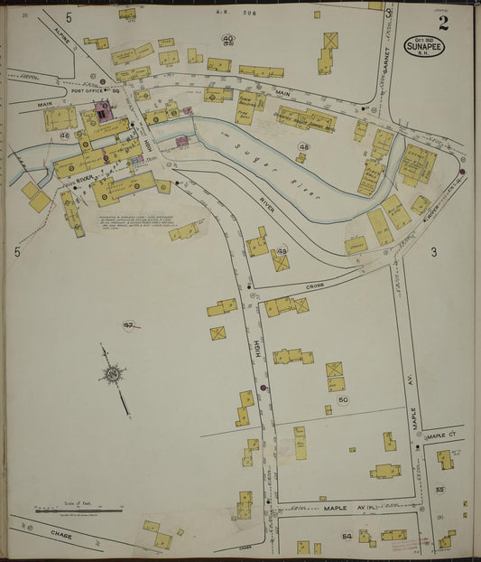
Sanborn Fire Insurance Map from Sunapee, Sullivan County, New Hampshire (1936) - Complete Map Set
Regular price $152.74 USDRegular priceUnit price per$179.70 USDSale price $152.74 USDSale -

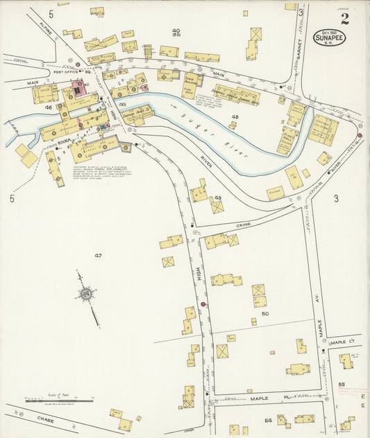
Sanborn Fire Insurance Map from Sunapee, Sullivan County, New Hampshire (1921) - Complete Map Set
Regular price $152.74 USDRegular priceUnit price per$179.70 USDSale price $152.74 USDSale -

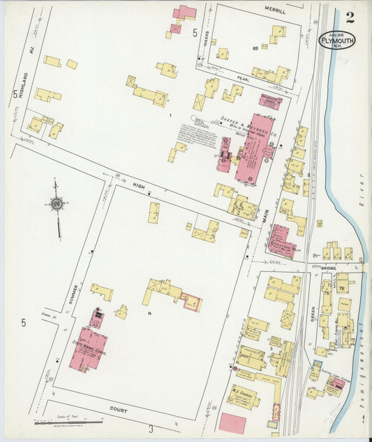
Sanborn Fire Insurance Map from Plymouth, Grafton County, New Hampshire (1918) - Complete Map Set
Regular price $152.74 USDRegular priceUnit price per$179.70 USDSale price $152.74 USDSale


