-
Sanborn Fire Insurance Map from Ada, Pontotoc County, Oklahoma (1902), Sheet #0001
Regular price $29.95 USDRegular priceUnit price per$39.95 USDSale price $29.95 USDSale -
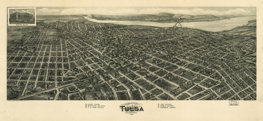
Aero view of Tulsa, Oklahoma 1918. (1918)
Regular price $29.95 USDRegular priceUnit price per$39.95 USDSale price $29.95 USDSale -
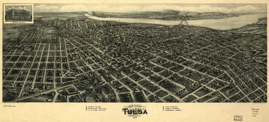
Aero view of Tulsa, Oklahoma, 1918. (1918)
Regular price $29.95 USDRegular priceUnit price per$39.95 USDSale price $29.95 USDSale -
Guthrie, Oklahoma, Indian Territory, Jan. 22nd 1890 (1890)
Regular price $29.95 USDRegular priceUnit price per$39.95 USDSale price $29.95 USDSale -
Edmond, Oklahoma Territory, 1891. (1891)
Regular price $29.95 USDRegular priceUnit price per$39.95 USDSale price $29.95 USDSale -
El Reno, Oklahoma Territory 1891. (1891)
Regular price $29.95 USDRegular priceUnit price per$39.95 USDSale price $29.95 USDSale -
Fort Reno, Oklahoma Territory 1891. (1891)
Regular price $29.95 USDRegular priceUnit price per$39.95 USDSale price $29.95 USDSale -
Bartlesville, Oklahoma 1917 (1917)
Regular price $29.95 USDRegular priceUnit price per$39.95 USDSale price $29.95 USDSale -
Ardmore, Indian Territory, 1891. (1891)
Regular price $29.95 USDRegular priceUnit price per$39.95 USDSale price $29.95 USDSale