Hometown History Maps
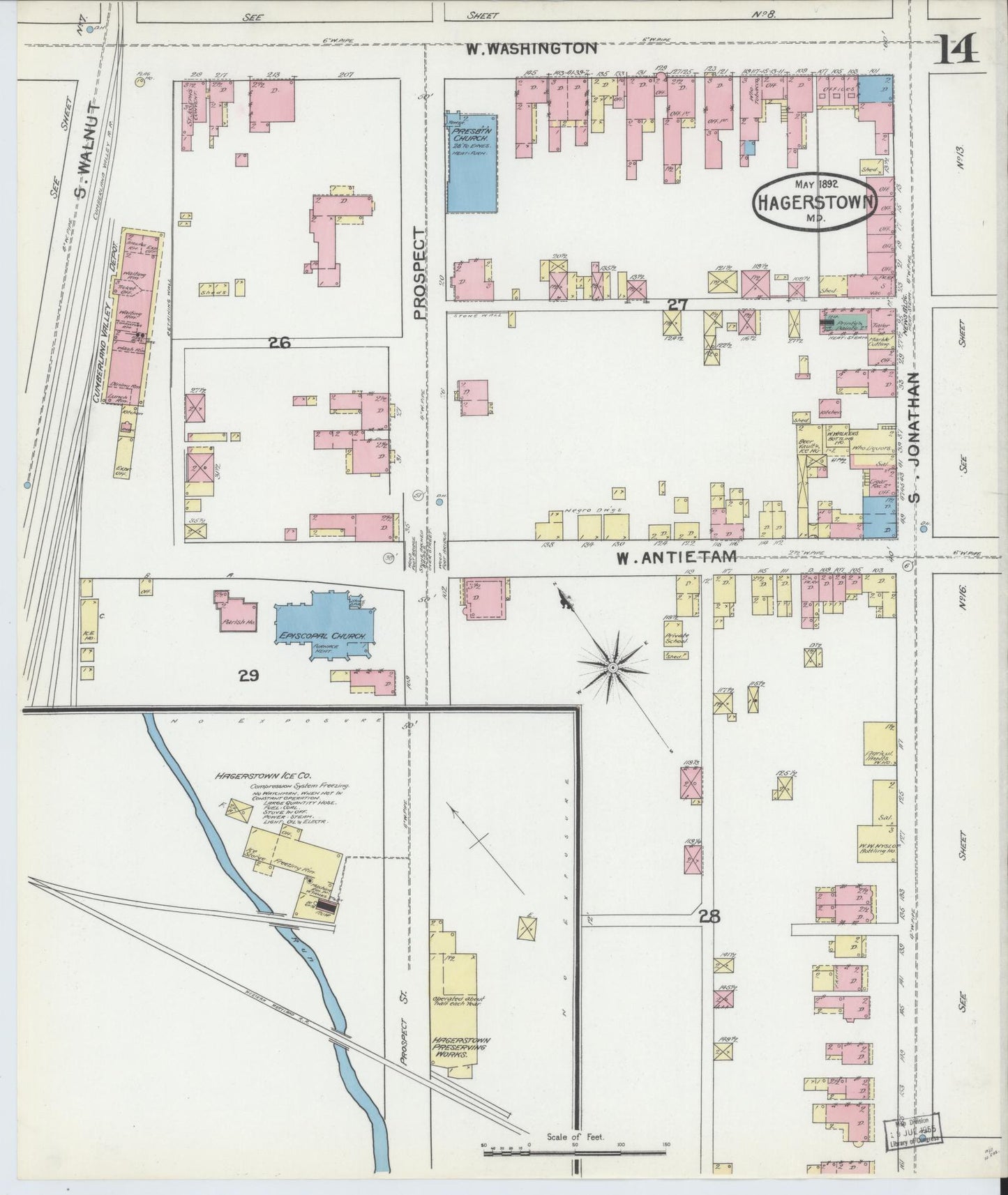
Washington, Maryland - 1892 - Sanborn Fire Insurance Map, Sheet #0014
Washington, Maryland - 1892 - Sanborn Fire Insurance Map, Sheet #0014
Couldn't load pickup availability
Share
Washington, Maryland - 1892 - Sanborn Fire Insurance Map, Sheet #0014
This is a high-resolution reproduction of a historic Sanborn fire insurance map sheet published in 1892. It is part of our exclusive collection of old maps for sale - perfect for home decor, genealogy research, or meaningful gifts.
Collectors often ask, 'where can I buy Sanborn maps?' Our shop makes it easy - this Maryland map is printed on premium paper and ships ready to frame.
Multi-sheet sets: This listing may be part of a multi-sheet set for Washington, Maryland. This item is Sheet #0014. Other sheets (downtown, neighborhoods, industrial areas) may exist for the same town and year. Click here to see if more sheets exist for Washington, Maryland (1892).
Buy the Complete Set & Save! (if available)
We preserve the original scanned map character - so historic notes, LOC stamps, scan lines and age marks may be visible. That authentic look is what makes our historic map prints so special.
Map courtesy of the Library of Congress, Geography & Map Division.
All Sanborn map prints are produced at 24" wide × 30" tall unless otherwise noted in the description above. The actual map image area measures 24" × 28", leaving 1" of extra space at the top and bottom to allow for easy trimming or to help center the map in a standard 24×30 frame. This ensures a frame-ready experience without the need for custom sizing.
📜 Historical Reproduction Notice:
These are high-resolution scans of original maps that are often more than 100 years old. As a result, you may see signs of scan lines, fold lines, Library of Congress stamps, ink marks, fading, or light creases. These unique characteristics are part of what makes each print historically authentic and visually engaging.
🎨 Color Accuracy:
Please note that colors may vary slightly from what you see on your screen due to differences in display settings and printed ink on satin photo paper. While we strive for excellent fidelity, no two screens—or printers—render colors identically.
🖼️ Other Print Types:
This sizing and format applies to all Sanborn map reproductions. Other prints, such as bird’s-eye views or illustrated cityscapes, may have different dimensions or image layouts. Please refer to the product description above for any specific size or format notes.
📦 Safe Shipping:
Every map is carefully rolled and shipped in a 24" heavy-duty cardboard tube to prevent bending or damage during delivery. This ensures your print arrives safely and ready to frame.