-
Bird's-eye view of Denver, 1887. (1887)
Regular price $29.95 USDRegular priceUnit price per$39.95 USDSale price $29.95 USDSale -
Sanborn Fire Insurance Map from Las Animas, Bent County, Colorado (1889), Sheet #0001
Regular price $29.95 USDRegular priceUnit price per$39.95 USDSale price $29.95 USDSale -
Sanborn Fire Insurance Map from Calhan, El Paso County, Colorado (1917), Sheet #0001
Regular price $29.95 USDRegular priceUnit price per$39.95 USDSale price $29.95 USDSale -
Sanborn Fire Insurance Map from Ault, Weld County, Colorado (1908), Sheet #0001
Regular price $29.95 USDRegular priceUnit price per$39.95 USDSale price $29.95 USDSale -
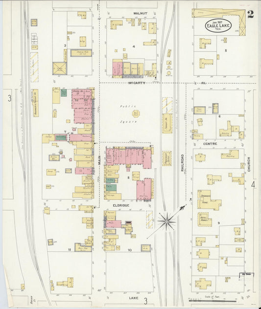
Sanborn Fire Insurance Map from Eagle Lake, Colorado County, Texas (1907) - Complete Map Set
Regular price $101.83 USDRegular priceUnit price per$119.80 USDSale price $101.83 USDSale -
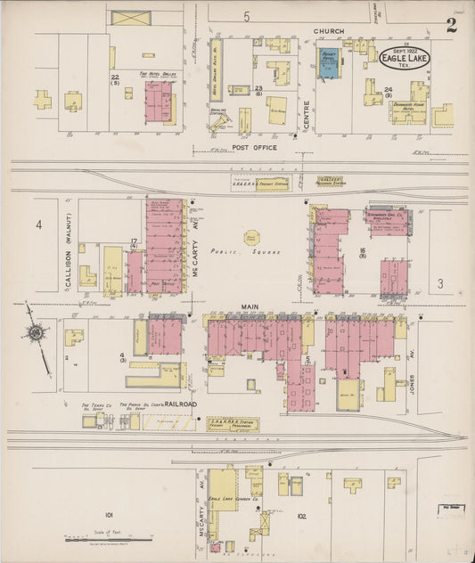
Sanborn Fire Insurance Map from Eagle Lake, Colorado County, Texas (1922) - Complete Map Set
Regular price $152.74 USDRegular priceUnit price per$179.70 USDSale price $152.74 USDSale -
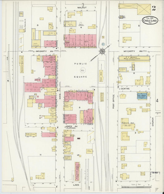
Sanborn Fire Insurance Map from Eagle Lake, Colorado County, Texas (1912) - Complete Map Set
Regular price $152.74 USDRegular priceUnit price per$179.70 USDSale price $152.74 USDSale -
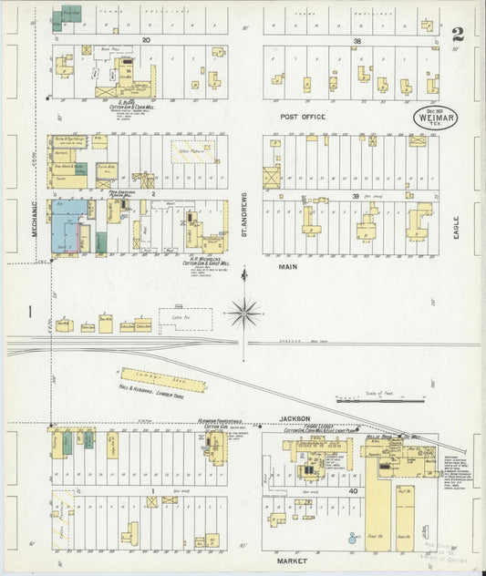
Sanborn Fire Insurance Map from Weimar, Colorado County, Texas (1901) - Complete Map Set
Regular price $59.90 USDRegular priceUnit price per$59.90 USDSale price $59.90 USD -
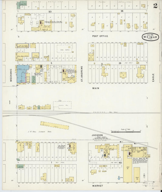
Sanborn Fire Insurance Map from Weimar, Colorado County, Texas (1896) - Complete Map Set
Regular price $59.90 USDRegular priceUnit price per$59.90 USDSale price $59.90 USD -
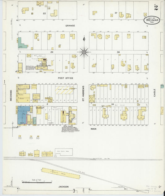
Sanborn Fire Insurance Map from Weimar, Colorado County, Texas (1907) - Complete Map Set
Regular price $76.37 USDRegular priceUnit price per$89.85 USDSale price $76.37 USDSale -
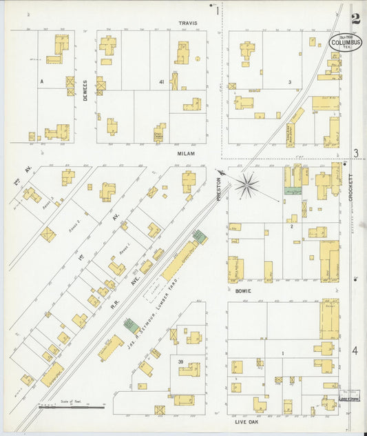
Sanborn Fire Insurance Map from Columbus, Colorado County, Texas (1900) - Complete Map Set
Regular price $127.29 USDRegular priceUnit price per$149.75 USDSale price $127.29 USDSale -
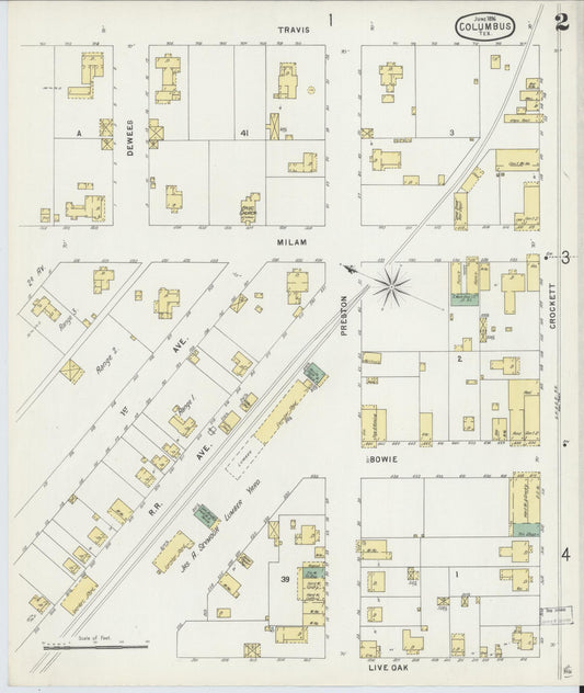
Sanborn Fire Insurance Map from Columbus, Colorado County, Texas (1896) - Complete Map Set
Regular price $127.29 USDRegular priceUnit price per$149.75 USDSale price $127.29 USDSale