-
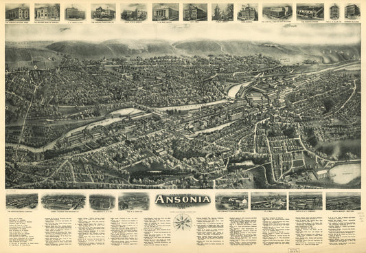
Aero view of Ansonia, Connecticut 1921. (1921)
Regular price $29.95 USDRegular priceUnit price per$39.95 USDSale price $29.95 USDSale -
View of Bethel, Conn. (1879)
Regular price $29.95 USDRegular priceUnit price per$39.95 USDSale price $29.95 USDSale -
Birmingham, Conn. 1876. (1876)
Regular price $29.95 USDRegular priceUnit price per$39.95 USDSale price $29.95 USDSale -
Bird's-eye view of Branford, Connecticut. (1905)
Regular price $29.95 USDRegular priceUnit price per$39.95 USDSale price $29.95 USDSale -
View of Bridgeport, Ct. 1875. (1875)
Regular price $29.95 USDRegular priceUnit price per$39.95 USDSale price $29.95 USDSale -
Bristol, Conn. looking north-east. (1889)
Regular price $29.95 USDRegular priceUnit price per$39.95 USDSale price $29.95 USDSale -
Bird's eye view of Bristol, Conn. 1907. (1907)
Regular price $29.95 USDRegular priceUnit price per$39.95 USDSale price $29.95 USDSale -
View of Cheshire, Connecticut 1882. (1882)
Regular price $29.95 USDRegular priceUnit price per$39.95 USDSale price $29.95 USDSale -
View of Clinton, Connecticut 1881. (1881)
Regular price $29.95 USDRegular priceUnit price per$39.95 USDSale price $29.95 USDSale -
View of Collinsville, Conn (1878)
Regular price $29.95 USDRegular priceUnit price per$39.95 USDSale price $29.95 USDSale -
View of Danbury, Conn. 1875. (1875)
Regular price $29.95 USDRegular priceUnit price per$39.95 USDSale price $29.95 USDSale -
Danbury, Conn. (1884)
Regular price $29.95 USDRegular priceUnit price per$39.95 USDSale price $29.95 USDSale