-
Birds eye view of the city of Louisiana, Pike County, Mo. (1876)
Regular price $29.95 USDRegular priceUnit price per$39.95 USDSale price $29.95 USDSale -
Birds' eye view of New-Orleans (1851)
Regular price $29.95 USDRegular priceUnit price per$39.95 USDSale price $29.95 USDSale -
New Orleans, La. and its vicinity. (1863)
Regular price $29.95 USDRegular priceUnit price per$39.95 USDSale price $29.95 USDSale -
Panorama of the World's Fair, St Louis, 1904. (1904)
Regular price $29.95 USDRegular priceUnit price per$39.95 USDSale price $29.95 USDSale -
Sanborn Fire Insurance Map from Abbeville, Vermilion Parish, Louisiana (1895) - Complete Map Set
Regular price $59.90 USDRegular priceUnit price per$59.90 USDSale price $59.90 USD -
Sanborn Fire Insurance Map from Abbeville, Vermilion Parish, Louisiana (1895), Sheet #0001
Regular price $29.95 USDRegular priceUnit price per$39.95 USDSale price $29.95 USDSale -
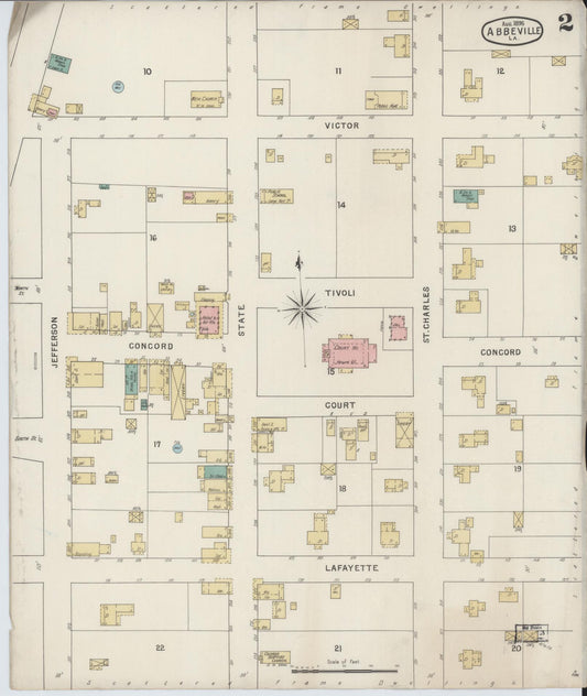
Sanborn Fire Insurance Map from Abbeville, Vermilion Parish, Louisiana (1895), Sheet #0002
Regular price $29.95 USDRegular priceUnit price per$39.95 USDSale price $29.95 USDSale -

Sanborn Fire Insurance Map from Abbeville, Vermilion Parish, Louisiana (1899) - Complete Map Set
Regular price $76.37 USDRegular priceUnit price per$89.85 USDSale price $76.37 USDSale -
Sanborn Fire Insurance Map from Abbeville, Vermilion Parish, Louisiana (1899), Sheet #0001
Regular price $29.95 USDRegular priceUnit price per$39.95 USDSale price $29.95 USDSale -
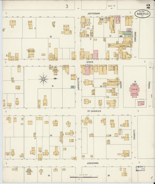
Sanborn Fire Insurance Map from Abbeville, Vermilion Parish, Louisiana (1899), Sheet #0002
Regular price $29.95 USDRegular priceUnit price per$39.95 USDSale price $29.95 USDSale -
Sanborn Fire Insurance Map from Abbeville, Vermilion Parish, Louisiana (1899), Sheet #0003
Regular price $29.95 USDRegular priceUnit price per$39.95 USDSale price $29.95 USDSale -

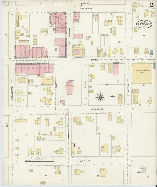
Sanborn Fire Insurance Map from Abbeville, Vermilion Parish, Louisiana (1907) - Complete Map Set
Regular price $152.74 USDRegular priceUnit price per$179.70 USDSale price $152.74 USDSale