-
Sanborn Fire Insurance Map from Overton, Rusk County, Texas (1939) - Complete Map Set
Regular price $127.29 USDRegular priceUnit price per$149.75 USDSale price $127.29 USDSale -
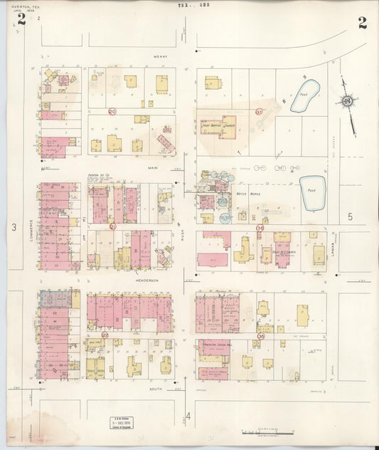
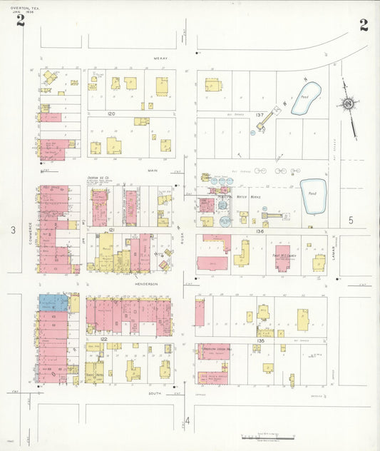
Sanborn Fire Insurance Map from Overton, Rusk County, Texas (1936) - Complete Map Set
Regular price $127.29 USDRegular priceUnit price per$149.75 USDSale price $127.29 USDSale -
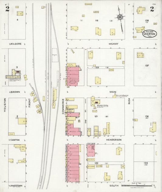
Sanborn Fire Insurance Map from Overton, Rusk County, Texas (1926) - Complete Map Set
Regular price $59.90 USDRegular priceUnit price per$59.90 USDSale price $59.90 USD -
Sanborn Fire Insurance Map from Overton, Rusk County, Texas (1907), Sheet #0001
Regular price $29.95 USDRegular priceUnit price per$39.95 USDSale price $29.95 USDSale -
Sanborn Fire Insurance Map from Overton, Rusk County, Texas (1893), Sheet #0001
Regular price $29.95 USDRegular priceUnit price per$39.95 USDSale price $29.95 USDSale -
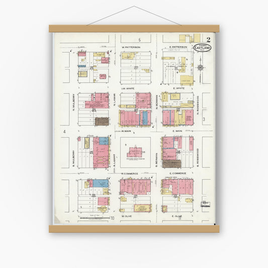
Sanborn Fire Insurance Map from Eastland, Eastland County, Texas (1920), Sheet #0002
Regular price $29.95 USDRegular priceUnit price per$39.95 USDSale price $29.95 USDSale -
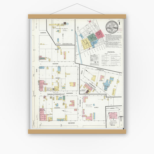
Sanborn Fire Insurance Map from Eagle Pass, Maverick County, Texas (1910), Sheet #0001
Regular price $29.95 USDRegular priceUnit price per$39.95 USDSale price $29.95 USDSale -
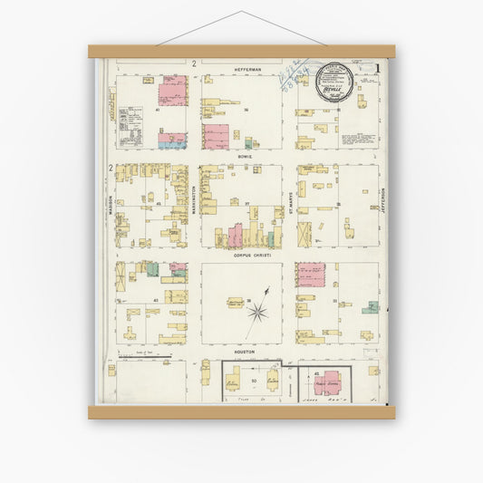
Sanborn Fire Insurance Map from Beeville, Bee County, Texas (1898), Sheet #0001
Regular price $29.95 USDRegular priceUnit price per$39.95 USDSale price $29.95 USDSale -
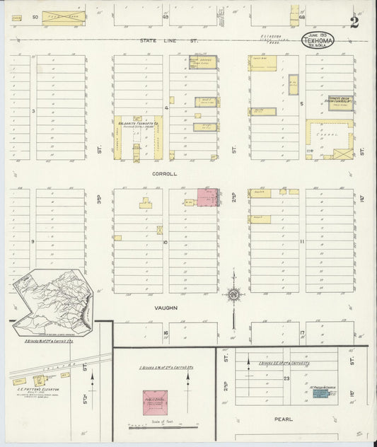
Sanborn Fire Insurance Map from Texhoma, Texas County, Oklahoma and Sherman County, Texas, Texas (1930) - Complete Map Set
Regular price $127.29 USDRegular priceUnit price per$149.75 USDSale price $127.29 USDSale -
Sanborn Fire Insurance Map from Texhoma, Texas County, Oklahoma and Sherman County, Texas, Texas (1922) - Complete Map Set
Regular price $127.29 USDRegular priceUnit price per$149.75 USDSale price $127.29 USDSale -
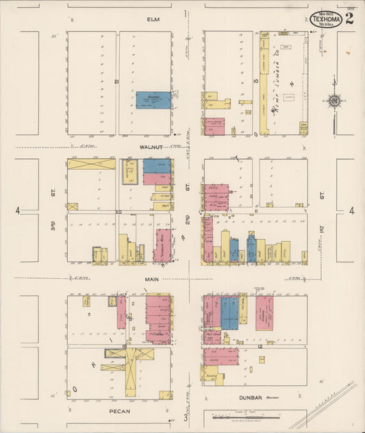
Sanborn Fire Insurance Map from Texhoma, Texas County, Oklahoma and Sherman County, Texas, Oklahoma (1913) - Complete Map Set
Regular price $59.90 USDRegular priceUnit price per$59.90 USDSale price $59.90 USD -
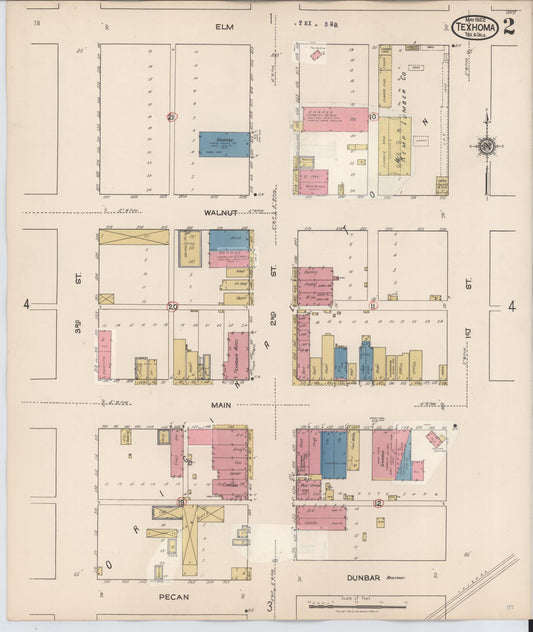
Sanborn Fire Insurance Map from Texhoma, Texas County, Oklahoma and Sherman County, Texas, Texas (1930), Sheet #0005
Regular price $29.95 USDRegular priceUnit price per$39.95 USDSale price $29.95 USDSale