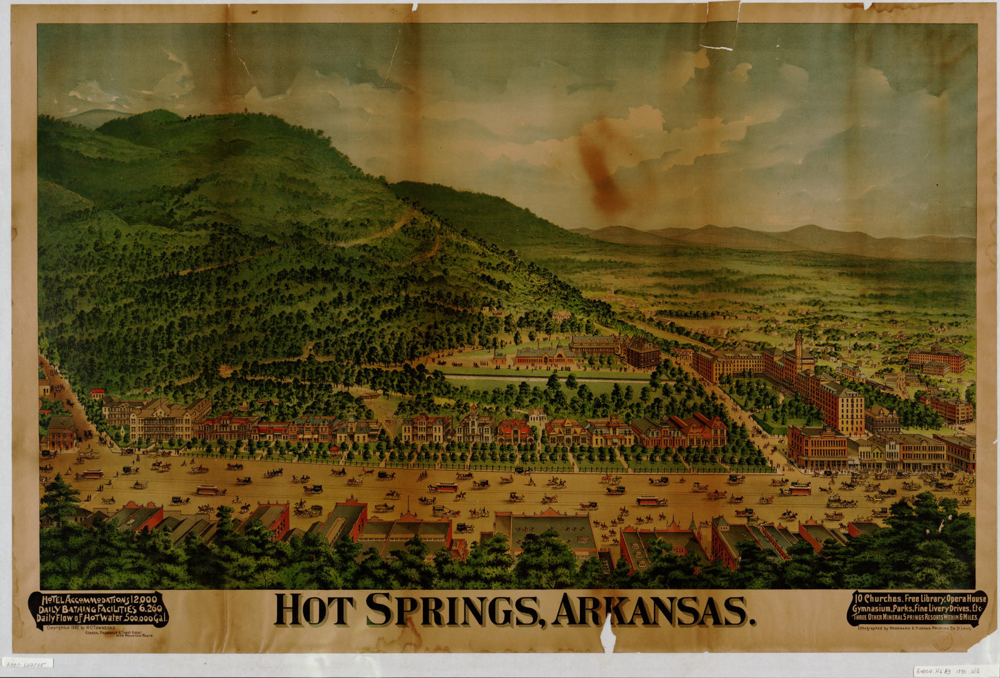
Old map of Hot Springs, Arkansas (1890)
Your town — over 100 years ago.
See Hot Springs exactly as it looked in 1890 — real streets, real buildings, and the places that shaped everyday life. Most people never realize how detailed their hometown history really is… until they see it like this.
This isn’t just a map — it’s your place in history.
Hometown History Maps
Hot Springs, Arkansas (1890)
Hot Springs, Arkansas (1890)
✅ Printed & shipped from Iowa, USA
📦 Ships same or next business day
🚚 Free USPS Economy shipping
⚡️ UPS Ground available for faster delivery
🖨️ Each map is printed on demand — never mass produced
Couldn't load pickup availability
Some tell stories about the past - Others display proof
Share
Hot Springs, Arkansas (1890)
This is a high-resolution reproduction of a historic bird’s-eye view panorama. It’s part of our exclusive collection of old maps for sale, perfect for decor, research, or gifts.
Printed on 24×36 inch premium paper. To preserve the original proportions, we never crop — the image is centered with white borders as needed. Ships ready to frame.
Map courtesy of the Library of Congress, Geography & Map Division (Panoramic Maps Collection).
All Sanborn map prints are produced at 24" × 30". The printed map area measures 24" × 28", leaving a 1" margin at the top and bottom for easy framing and alignment.
🖼️ Other Map Styles
Bird’s-eye views, panoramic, military, railroad and illustrated city maps are printed at 24" × 36" (unless otherwise noted in product description) and centered with white borders to preserve the original proportions.
📜 Historical Reproduction
These are high-resolution scans of original maps—often over 100 years old. You may notice fold lines, stamps, or light imperfections that reflect the map’s authentic history.
📦 Shipping
Each map is carefully rolled and shipped in a 24" heavy-duty tube to ensure safe delivery.
🗺️ Map Details
These reprints are created from Library of Congress materials. Some sets may not include every sheet due to source limitations. Please review the preview images carefully — what you see is exactly what you’ll receive.