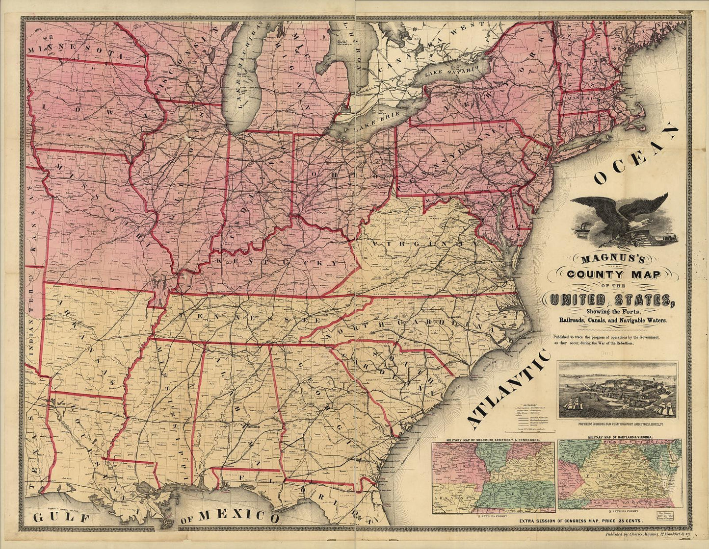
Old map of Magnus's county map of the United States, showing the forts, railroads, canals, and navigable waters during the War of the Rebellion. (showing the forts railroads canals and navigable waters during the War of the Rebellion.)
Your town — over 100 years ago.
See Magnus's county map of the United States exactly as it looked in showing the forts railroads canals and navigable waters during the War of the Rebellion. — real streets, real buildings, and the places that shaped everyday life. Most people never realize how detailed their hometown history really is… until they see it like this.
This isn’t just a map — it’s your place in history.
Hometown History Maps
Magnus's county map of the United States, showing the forts, railroads, canals, and navigable waters during the War of the Rebellion.
Magnus's county map of the United States, showing the forts, railroads, canals, and navigable waters during the War of the Rebellion.
✅ Printed & shipped from Iowa, USA
📦 Ships same or next business day
🚚 Free USPS Economy shipping
⚡️ UPS Ground available for faster delivery
🖨️ Each map is printed on demand — never mass produced
Couldn't load pickup availability
Some tell stories about the past - Others display proof
Share
Magnus's county map of the United States, showing the forts, railroads, canals, and navigable waters. Published to trace the progress of operations by the government, as they occur, during the War of the Rebellion.
This high-quality reproduction of an original Civil War era map shows maps during the American Civil War, around 1862.
Originally created to document battlefields, troop positions, fortifications, transportation routes, and strategic geography, it now makes a striking piece of historic wall art.
We do not digitally restore or alter these maps. All original details are preserved, including fold lines, ink marks, handwritten notes, age toning, and small tears or imperfections. These authentic signs of use are part of the map's story and character.
Each print is produced at 24 inches on its longest side (either width or height). The other dimension is scaled proportionally based on the original map, so the full image is shown uncropped. Your map arrives ready to frame.
Perfect for:
- Civil War history buffs and collectors
- reenactors and battlefield visitors
- teachers, classrooms, and libraries
- museum gift shops and local history displays
- anyone who loves detailed historic maps and wall art
Source: Map courtesy of the Library of Congress, Civil War Maps collection (public domain).
All Sanborn map prints are produced at 24" × 30". The printed map area measures 24" × 28", leaving a 1" margin at the top and bottom for easy framing and alignment.
🖼️ Other Map Styles
Bird’s-eye views, panoramic, military, railroad and illustrated city maps are printed at 24" × 36" (unless otherwise noted in product description) and centered with white borders to preserve the original proportions.
📜 Historical Reproduction
These are high-resolution scans of original maps—often over 100 years old. You may notice fold lines, stamps, or light imperfections that reflect the map’s authentic history.
📦 Shipping
Each map is carefully rolled and shipped in a 24" heavy-duty tube to ensure safe delivery.
🗺️ Map Details
These reprints are created from Library of Congress materials. Some sets may not include every sheet due to source limitations. Please review the preview images carefully — what you see is exactly what you’ll receive.