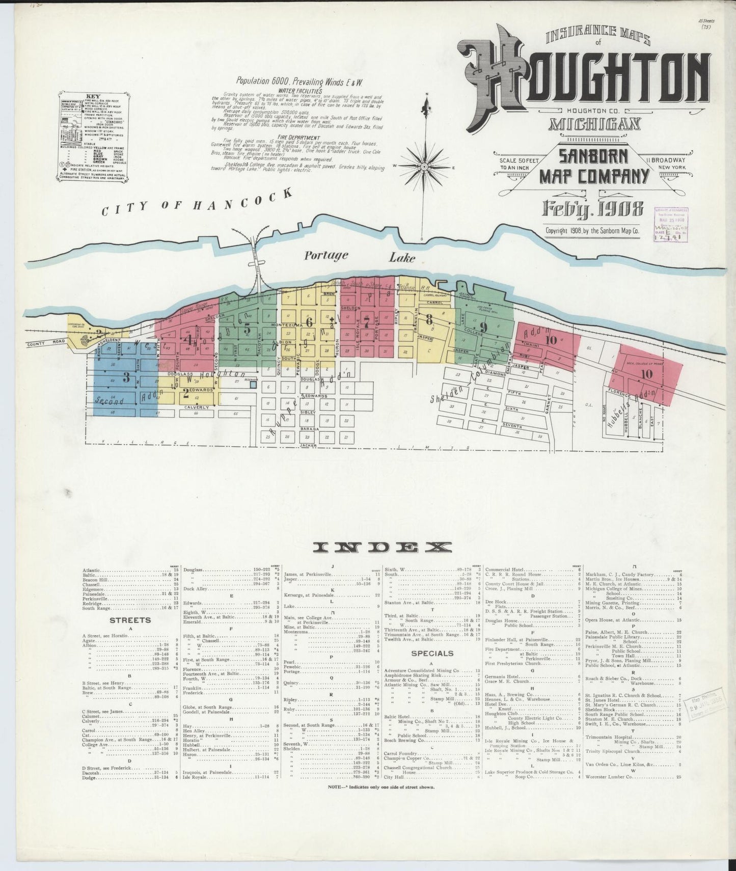
Old map of Houghton, County, Michigan (1908)
Your town — over 100 years ago.
See Houghton exactly as it looked in 1908 — real streets, real buildings, and the places that shaped everyday life. Most people never realize how detailed their hometown history really is… until they see it like this.
This isn’t just a map — it’s your place in history.
Hometown History Maps
Sanborn Fire Insurance Map from Houghton, Houghton County, Michigan (1908), Sheet #0001
Sanborn Fire Insurance Map from Houghton, Houghton County, Michigan (1908), Sheet #0001
✅ Printed & shipped from Iowa, USA
📦 Ships same or next business day
🚚 Free USPS Economy shipping
⚡️ UPS Ground available for faster delivery
🖨️ Each map is printed on demand — never mass produced
Couldn't load pickup availability
Some tell stories about the past - Others display proof
Share
Sanborn Fire Insurance Map from Houghton, Houghton County, Michigan (1908), Sheet #0001
This is a high-resolution reproduction of a historic Sanborn fire insurance map sheet published in 1908. It is part of our exclusive collection of old maps for sale - perfect for home decor, office decor, restaurant decor, lobby art, genealogy research, or meaningful gifts.
Collectors often ask, 'where can I buy Sanborn maps?' Our shop makes it easy - this Michigan map is printed on premium paper and ships ready to frame.
Multi-sheet set: This listing is Sheet #0001. Additional sheets (downtown, neighborhoods, industrial areas) may be available for the same title/year. View all sheets for this map set (1908).
We preserve the original character - no tight cropping; tasteful borders as needed - so historic notes, stamps, and age marks may be visible. That authentic look is what makes our historic map prints so special.
Map courtesy of the Library of Congress, Geography & Map Division.
All Sanborn map prints are produced at 24" × 30". The printed map area measures 24" × 28", leaving a 1" margin at the top and bottom for easy framing and alignment.
🖼️ Other Map Styles
Bird’s-eye views, panoramic, military, railroad and illustrated city maps are printed at 24" × 36" (unless otherwise noted in product description) and centered with white borders to preserve the original proportions.
📜 Historical Reproduction
These are high-resolution scans of original maps—often over 100 years old. You may notice fold lines, stamps, or light imperfections that reflect the map’s authentic history.
📦 Shipping
Each map is carefully rolled and shipped in a 24" heavy-duty tube to ensure safe delivery.
🗺️ Map Details
These reprints are created from Library of Congress materials. Some sets may not include every sheet due to source limitations. Please review the preview images carefully — what you see is exactly what you’ll receive.


Customers are saying
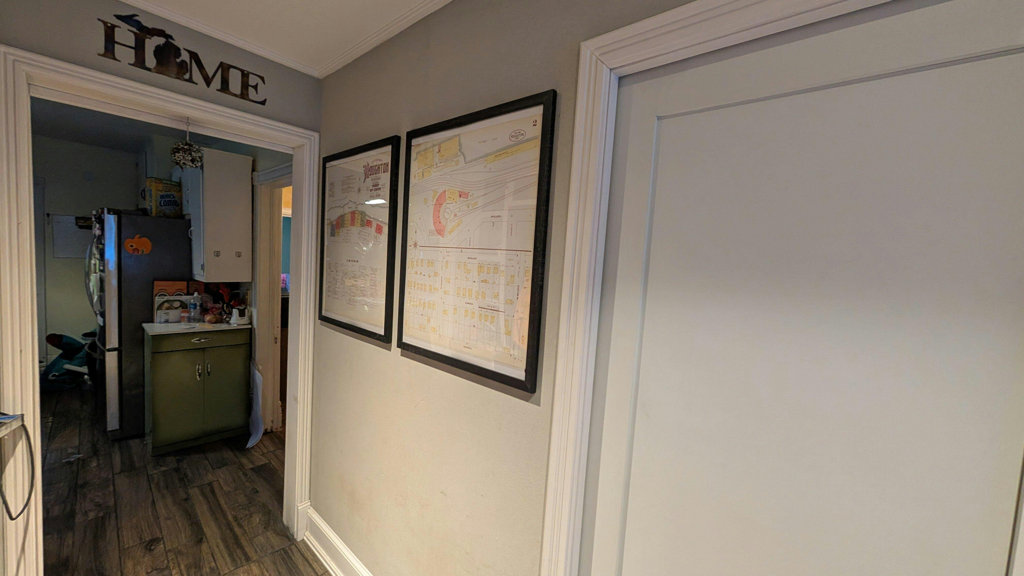
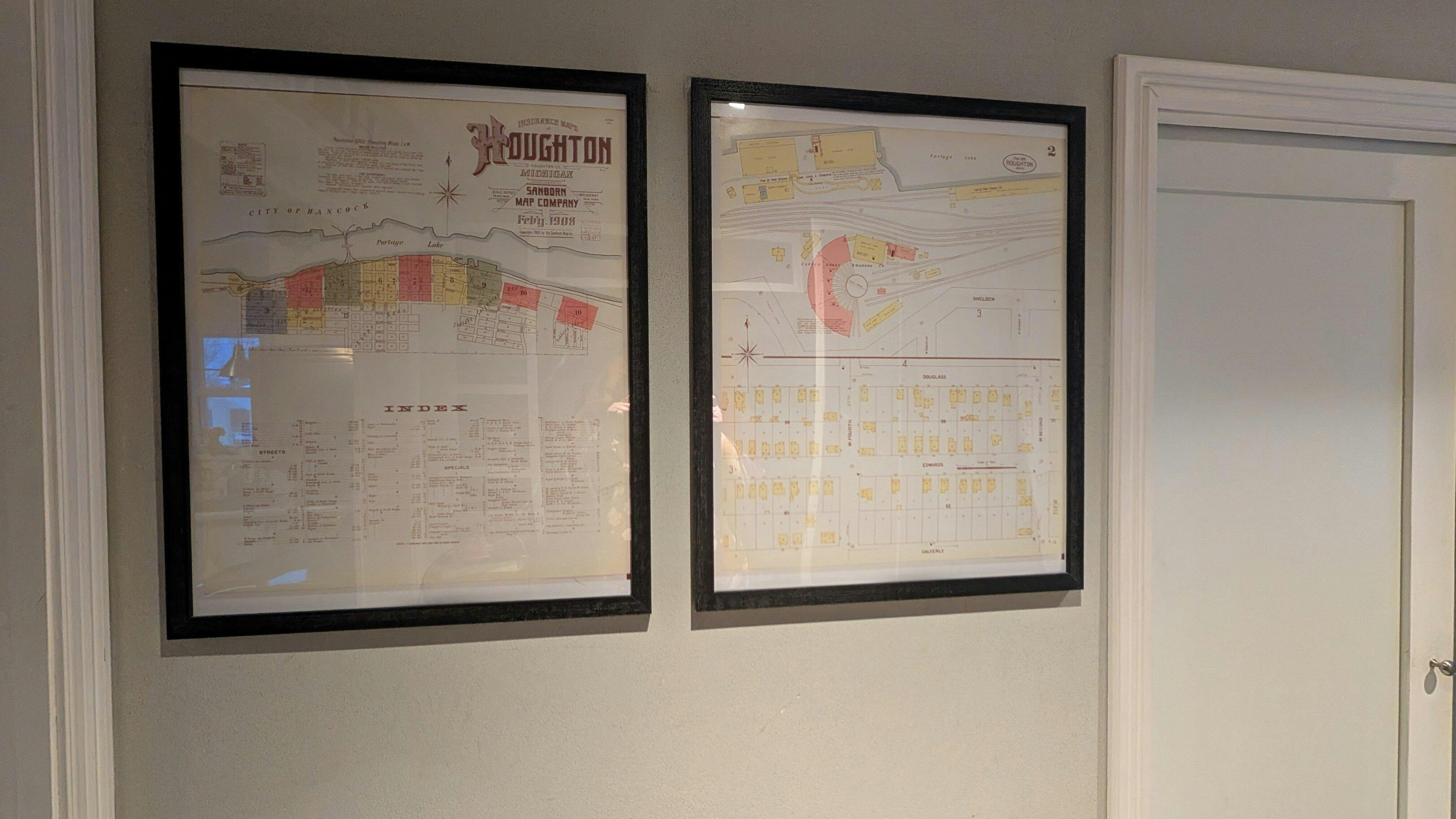
"I just wanted to share these photos with you. I asked for the Houghton 1908 Sanborn sheet 1 and 2. We bought our first home here a year ago, the city records say the home is from 1960, but we knew just based in on the style of the home that couldn't be right. I started working backwards through public Census data as far back as I could go with online records and eventually while I was searching came across your maps. I was able to locate my home on sheet 2 of the 1908 map and was very excited! I asked my parents for the Houghton map and Sheet 2 for Christmas. Here they are! They look great! "
"I love buying from smaller businesses rather than big companies, because it's much more personal. The quality is great and I am very happy."