-
Sanborn Fire Insurance Map from Detroit, Wayne County, Michigan (1904), Sheet #0001
Regular price $29.95 USDRegular priceUnit price per$39.95 USDSale price $29.95 USDSale -
Sanborn Fire Insurance Map from Detroit, Wayne County, Michigan (1889), Sheet #0001
Regular price $29.95 USDRegular priceUnit price per$39.95 USDSale price $29.95 USDSale -


Sanborn Fire Insurance Map from Saint Johns, Clinton County, Michigan (1900) - Complete Map Set
Regular price $127.29 USDRegular priceUnit price per$149.75 USDSale price $127.29 USDSale -
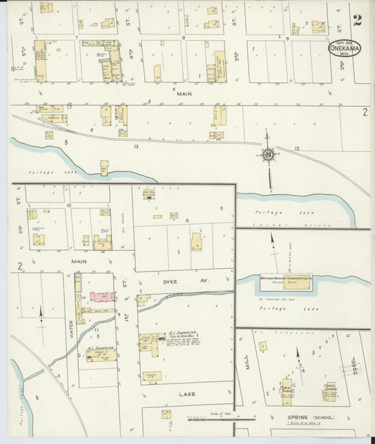
Sanborn Fire Insurance Map from Onekama, Manistee County, Michigan (1914) - Complete Map Set
Regular price $59.90 USDRegular priceUnit price per$59.90 USDSale price $59.90 USD -
Sanborn Fire Insurance Map from Onekama, Manistee County, Michigan (1900) - Complete Map Set
Regular price $59.90 USDRegular priceUnit price per$59.90 USDSale price $59.90 USD -
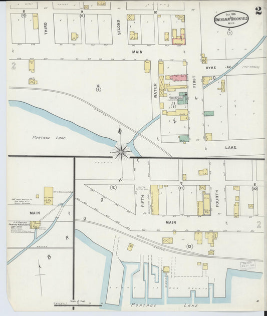
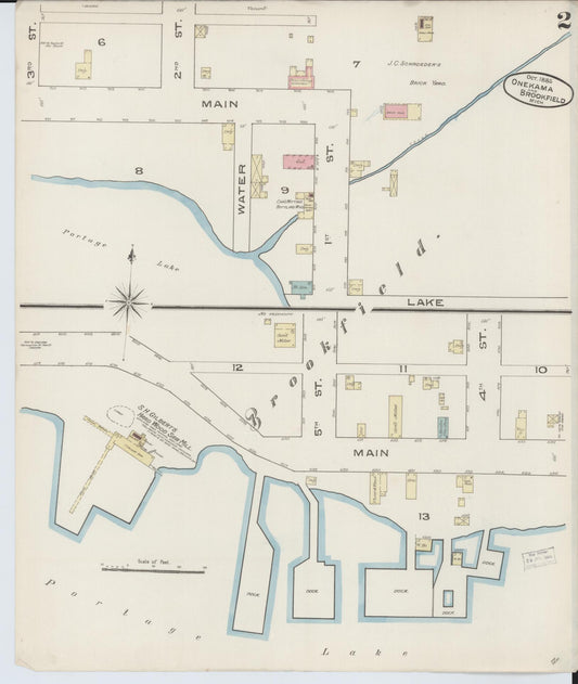
Sanborn Fire Insurance Map from Onekama, Manistee County, Michigan (1895) - Complete Map Set
Regular price $59.90 USDRegular priceUnit price per$59.90 USDSale price $59.90 USD -
Sanborn Fire Insurance Map from Onekama, Manistee County, Michigan (1885) - Complete Map Set
Regular price $59.90 USDRegular priceUnit price per$59.90 USDSale price $59.90 USD -
Sanborn Fire Insurance Map from Ypsilanti, Washtenaw County, Michigan (1888), Sheet #0001
Regular price $29.95 USDRegular priceUnit price per$39.95 USDSale price $29.95 USDSale -
Sanborn Fire Insurance Map from Red Jacket, Houghton County, Michigan (1908), Sheet #0002
Regular price $29.95 USDRegular priceUnit price per$39.95 USDSale price $29.95 USDSale -
Sanborn Fire Insurance Map from Ithaca, Gratiot County, Michigan (1911), Sheet #0007
Regular price $29.95 USDRegular priceUnit price per$39.95 USDSale price $29.95 USDSale -
Sanborn Fire Insurance Map from Houghton, Houghton County, Michigan (1908), Sheet #0002
Regular price $29.95 USDRegular priceUnit price per$39.95 USDSale price $29.95 USDSale -
Sanborn Fire Insurance Map from Houghton, Houghton County, Michigan (1908), Sheet #0001
Regular price $29.95 USDRegular priceUnit price per$39.95 USDSale price $29.95 USDSale