-

Sanborn Fire Insurance Map from Hartsville, Darlington County, South Carolina (1910), Sheet #0004
Regular price $29.95 USDRegular priceUnit price per$39.95 USDSale price $29.95 USDSale -

Sanborn Fire Insurance Map from Hartsville, Darlington County, South Carolina (1910), Sheet #0001
Regular price $29.95 USDRegular priceUnit price per$39.95 USDSale price $29.95 USDSale -
Sanborn Fire Insurance Map from Piedmont, Greenville and Anderson Counties, South Carolina (1902) - Complete Map Set
Regular price $59.90 USDRegular priceUnit price per$59.90 USDSale price $59.90 USD -
Sanborn Fire Insurance Map from McCormick, McCormick County, South Carolina (1917) - Complete Map Set
Regular price $59.90 USDRegular priceUnit price per$59.90 USDSale price $59.90 USD -
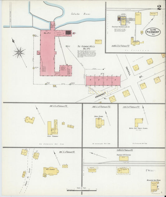
Sanborn Fire Insurance Map from Piedmont, Greenville and Anderson Counties, South Carolina (1908) - Complete Map Set
Regular price $76.37 USDRegular priceUnit price per$89.85 USDSale price $76.37 USDSale -
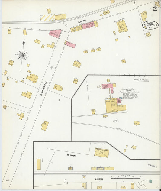
Sanborn Fire Insurance Map from Ninety Six, Greenwood County, South Carolina (1912) - Complete Map Set
Regular price $59.90 USDRegular priceUnit price per$59.90 USDSale price $59.90 USD -
Sanborn Fire Insurance Map from Ninety Six, Greenwood County, South Carolina (1906) - Complete Map Set
Regular price $59.90 USDRegular priceUnit price per$59.90 USDSale price $59.90 USD -
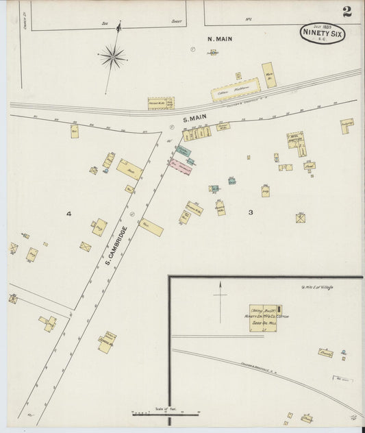
Sanborn Fire Insurance Map from Ninety Six, Greenwood County, South Carolina (1901) - Complete Map Set
Regular price $59.90 USDRegular priceUnit price per$59.90 USDSale price $59.90 USD -
Sanborn Fire Insurance Map from Ninety Six, Greenwood County, South Carolina (1894) - Complete Map Set
Regular price $59.90 USDRegular priceUnit price per$59.90 USDSale price $59.90 USD -
Sanborn Fire Insurance Map from Ninety Six, Greenwood County, South Carolina (1889) - Complete Map Set
Regular price $59.90 USDRegular priceUnit price per$59.90 USDSale price $59.90 USD -
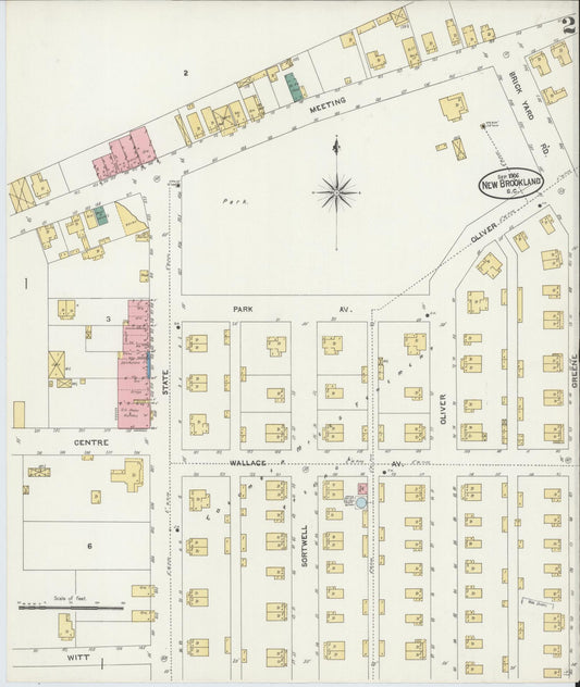
Sanborn Fire Insurance Map from New Brookland, Lexington County, South Carolina (1906) - Complete Map Set
Regular price $59.90 USDRegular priceUnit price per$59.90 USDSale price $59.90 USD -
Sanborn Fire Insurance Map from York[ville], York County, South Carolina (1894) - Complete Map Set
Regular price $59.90 USDRegular priceUnit price per$59.90 USDSale price $59.90 USD


![Sanborn Fire Insurance Map from York[ville], York County, South Carolina (1894), Sheet #0001 - Complete Map Set gallery image, historic Sanborn map, vintage wall art, South Carolina South Carolina](http://hometownhistorymaps.com/cdn/shop/files/default_b6393e97-53ad-4cae-b661-7732ab6e2bd6.jpg?v=1763735578&width=533)
